
|
|
Project
>
Objectives
Objectives
• Large parts of southern Europe lie in geodynamic active zones and are
increasingly vulnerable to earthquakes and volcanic activities. Mt. Etna is
erupting almost continuously, devastating villages and agricultural land on
its southern flanks. Although the last catastrophic volcanic eruption of Vesuvius
dates back to 1906, the danger of a reactivation is real.
• Socio-economical aspects, land use, tourist and industrial planning
as well as environmental protection increasingly require needs of natural hazard
assessment. In this respect, two regions are of major concern: The Nisyros/Kos
volcanic field which suffered the largest volcanic eruption in the Eastern Mediterranean
160 000 years ago and the Campanian volcanic province including the Campi Flegrei
and Vesuvius, today densely populated by approximately 3.5 million people.
• These quiescent but active volcanoes represent a severe hazard and risk
potential and require integrated monitoring, satellite surveying and modelling.
Monitored geodetic, seismic and geochemical data together with satellite images
are transferred and unified in a coherent way to allow integration into a geo-spatial
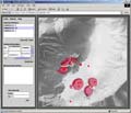
information system (GIS). A completely new, interactive, and user-friendly software
tool has been developed as a Web based multimedia platform encompassing a workflow
of graphical 2 to 4D landscape models and all monitored data.
• The “Volcano-Early Warning System” “GEOWARN”
is designed on scientific basis to cover the most important gap, the step form
green to yellow of the international “Volcano Alert Levels”, which
is related to the earliest recognition of reactivation of magmatic activity
within the crust that might lead to an volcanic eruption at the surface. In
case of reactivation, implementation of real-time monitoring into the early-warning
system would then permit volcanic eruption prediction (long-term or the step
from yellow to orange) or forecast (the short-term step from orange to red).
• This software package will be implemented at national councils and civil
protection agencies to be used as an early-warning system including the basis
for hazard assessment, vulnerability and risk studies as well as for and emergency
planning. In addition, the new information system incorporates educational information
accessible to the public in order to generate awareness.
|


|