Home
Project Objectives Pilot Sites Overview Nisyros (Greece) Methodologies Oceanographic and Geophysical Surveys The Ocean Floor Mapping System Using Sea Beam Sea Floor Seismic Reflection Soundings Seismic Activity and Monitoring Gravity and magnetic surveys The GPS network Satellite Imaging Ikonos Satellite Imaging Thermal Satellite Imaging Differential Radar Interferometry (DInSAR) Ground-based heat and CO2 flux measurements CO2 Flux Monitoring and Diffuse Degassing Structures (DDS) Geochemical Monitoring of the Hydrothermal System of Nisyros Systematic periodic measurements of thermal waters Thermal Infrared (IR) Camera Imaging The infrared thermal imager NEC Thermo Tracer Geological History of Sites The volcanic history Introduction The Basal Volcanic Complex (ca. 160,000-100,000 years) The Early Caldera Stratovolcano (ca. 100,000-30,000 years) Lakki Pyroclastics and Avlaki Complex Lacustrine and Pyroclastic Formations The Melisseri - Evangelistra - Afionas Complex The Emborios Complex The Ellinika - Kyra - Lies Pyroclastic Complex The Argos - Stavros Complex The Main Caldera Formation (30,000 to 15,000 years ?) The First Caldera Phase (?30,000 to 20,000 years ?) The Second Caldera Phase (20,000 to <15,000 years ?) Volcano-Tectonic Structures The Nisyros Hydrothermal Crater Field Fumarolic Activity The Nisyros Hydrothermal System
GEOWARN Design Introduction The GEOWARN spatial database The New GEOWARN Multimedia Information System
Transferability of GEOWARN systems to other European volcanoes Overview The Second Test Site Campi Flegrei (Italy) Campi Flegrei The second test site Campi Flegrei (Italy) - a Transferability Test The Solfatara Volcano Monitoring of the Hydrothermal System of Solfatara Volcano Physical-numerical modeling The geochemical data set as a basis for physical modeling Numerical simulation The physical-numerical model
The Final GEOWARN Product Early Warning System and Emergency Plan The Volcano Early Warning System Early Recognition of Reactivation of a Magmatic System Overview Reactivation of Volcanic Activity The Concept of Volcanic Eruption Scenarios Prediction of Volcanic Activity and Related Earthquakes GEOWARN Emergency Planning and Mitigation
Innovation and Outlook Potential Users The Geowarn Consortium - Further Information
Links
Software screenshots
Site Map
Several methodologies are applied in a completely new way to achieve the necessary results.
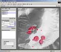
Take a look at the software graphical user interface.
Watch illustrative movies of the project.
Back
Top
created by geopublic