
|
|
| |

|
The Final GEOWARN Product Early Warning System and Emergency Plan > GEOWARN Emergency Planning and Mitigation
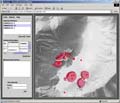
GEOWARN Emergency Planning and MitigationThe inability to have access to instant on-site visualization and quantification is currently a major issue in decision-making, emergency planning, evacuation, and rescue management, in the case of volcanic warning levels orange (hazard warning, eruption likely) and red (alert, eruption under way). This important need has been addressed by GEOWARN and can now be easily achieved within the GEOWARN system by visualization and comparison of the pre-eruptive situation with simulations of the various most likely eruption scenarios.
|
|
||||||||||||||||||||||||||||||||||||||||||||||||||||||
|
© 2003 eth zürich | Legal Disclaimer |
|
!!! Dieses Dokument stammt aus dem ETH Web-Archiv und wird nicht mehr gepflegt !!!
!!! This document is stored in the ETH Web archive and is no longer maintained !!! |
||