
|
|
| |

|
Project > Methodologies > Oceanographic and Geophysical Surveys
Oceanographic and Geophysical Surveys
The Ocean Floor Mapping System Using Sea Beam Gravity and magnetic surveys within the Kos - Yali - Nisyros - Tilos volcanic fieldThe study of density and magnetic fields is very important to the understanding
of physical and geological processes in a geodynamically active volcanic field.
The detailed measurements of gravity and magnetic fields permits the creation
of a 3D density and magnetic susceptibility model of the Nisyros volcano, based
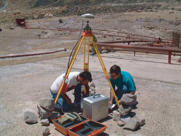
on passive and active seismic 3D topography results. Fig. 17 Gravimetric and Differential Global Positioning System
(DGPS) station in the Nisyros caldera (location: geothermal well 2). National
Kapodistrian University of Athens (NKUA) (Click on image to enlarge).
|
|
||||||||||||||||||||||||||||||||||||||||||||||||||||||
|
© 2003 eth zürich | Legal Disclaimer |
|
!!! Dieses Dokument stammt aus dem ETH Web-Archiv und wird nicht mehr gepflegt !!!
!!! This document is stored in the ETH Web archive and is no longer maintained !!! |
||