GEOWARN
Geospatial warning systems
Project | GEOWARN Design | Transferability | Final Product | Innovation/Outlook


Home | Links | Site Map


Authors of www.geowarn.ethz.ch:
Prof. Dr. V.J. Dietrich
Institute for Mineralogy and Petrography
ETH Zürich

Prof. Dr. Lorenz Hurni
Institute of Cartography
ETH Zürich

The Final GEOWARN Product Early Warning System and Emergency Plan > Early Recognition of Reactivation of a Magmatic System > The Concept of Volcanic Eruption Scenarios within the Kos-Yali-Nisyros-Tilos Volcanic Field

The Concept of Volcanic Eruption Scenarios within the Kos-Yali-Nisyros-Tilos Volcanic Field

For Nisyros and the surrounding volcanic field, several possible hypothetical hazards have been investigated on the basis of all morphological, geological, geophysical and geochemical data sets and monitoring results: (1) earthquakes, volcanic eruptions, and hydrothermal explosions are seen as primary hazards; and (2) landslides, tsunamis, rock falls, and mudflows are considered secondary hazards resulting from earthquakes and volcanic activity.

(1) Three major types of primary volcanic eruption scenarios can be considered:

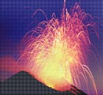
  • "Strombolian eruptive activity": eruptive activity during a short period of time (days to weeks),
  • "Vulcanian eruptive activity": explosive eruptive activity (phreatomagmatic) during a short to intermediate period of time (weeks to months),
  • "Sub-Plinian to Plinian eruptive activity": strong to extreme explosive eruptive activity (phreatomagmatic) during an intermediate to long period of time (months to a few years).


(2) Recognition of secondary hazards resulting from earthquakes and volcanic eruptions: The combination of the geotechnical map with a morpho-tectonic slope map generated a "Slope Stability Map", which will serve as a basis of hazard and site identification, in conjunction with earthquake activity and volcanic eruption scenarios. This map allows the immediate recognition of four major secondary hazard elements: rock falls, landslides combined with flood waves, hydrothermal eruptions, and ground movement due to fault displacements.


Methodologies     

Several methodologies are applied in a completely new way to achieve the necessary results.


Software screenshots

Take a look at the software graphical user interface.

Screenshot

Movies                    

Watch illustrative movies of the project.


Logo geowarn

Logo IST

Logo ETH Zürich


Back

Top 


created by geopublic

© 2003 eth zürich Legal Disclaimer
!!! Dieses Dokument stammt aus dem ETH Web-Archiv und wird nicht mehr gepflegt !!!
!!! This document is stored in the ETH Web archive and is no longer maintained !!!