GEOWARN
Geospatial warning systems
Project | GEOWARN Design | Transferability | Final Product | Innovation/Outlook


Home | Links | Site Map


Authors of www.geowarn.ethz.ch:
Prof. Dr. V.J. Dietrich
Institute for Mineralogy and Petrography
ETH Zürich

Prof. Dr. Lorenz Hurni
Institute of Cartography
ETH Zürich

Project > Methodologies > Oceanographic and Geophysical Surveys

Oceanographic and Geophysical Surveys

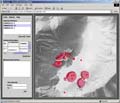
The Ocean Floor Mapping System Using Sea Beam
Sea Floor Seismic Reflection Soundings (Generation of a Local Velocity Model)
Seismic Monitoring (The Generation of a Regional Velocity Model)
Seismic Activity and Monitoring within the Kos - Yali - Nisyros - Tilos Volcanic Field
Gravity and magnetic surveys within the Kos - Yali - Nisyros - Tilos volcanic field
The GPS network

Seismic Activity and Monitoring within the Kos - Yali - Nisyros - Tilos Volcanic Field

The seismic activity in the south-easternmost part of the Aegean Volcanic Arc is very high, both at shallow and at intermediate focal depths. Figure 3 shows the epicenter distribution of the earthquakes with surface magnitude Ms>4.0 for the time period 1900-2000; data are taken from the monthly Bulletin of the Institute of Geodynamics of the National Observatory of Athens.

Fig.15

Fig. 15 Seismic activity within the Kos-Yali-Nisyros-Tilos volcanic field during the period 1900 - 2000 (earthquakes with surface magnitudes MS>4). National Observatory of Athens, Institute of Geodynamics (NOAIG)
(Click on image to enlarge).

In 1995, significant seismic activity began in the area surrounding Nisyros island. Specifically, on August 22, 1995, a moderate offshore earthquake of magnitude M=5.3 occurred at a distance of about 40 km west of the island, at a focal depth of 165 km.

Two months later, on November 30, 1995, a second event of the same magnitude took place very close to the volcano, at a focal depth of 136 km. On April 12, 1996, a stronger earthquake of Ms=5.5 occurred in the same focal region between Nisyros and Yali islands and at a focal depth of 156 km.

After that event, the seismic activity migrated to the southeast of Nisyros, where a strong offshore earthquake of Ms=6.6 took place west of Rhodes Island.

The microseismic activity in that region was monitored by a dense digital portable network consisting of 22 three-component onshore stations. Numerous micro-earthquakes (M<3) were recorded. Most of the hypocenters have shallow depths (<15 km) and are distributed in the marine environment between Nisyros and Kos.

The results of seismic monitoring during the time span 2000 and 2001 are shown in Figure 16. At first glance, it may appear that the seismicity in the Kos-Yali-Nisyros-Tilos volcanic field has decreased compared to that of the time of the seismic crisis in 1996-1998.

Several significant observations and interpretations can be made on the basis of the spatial distribution of the micro-seismic foci:

1) Very weak micro-earthquakes at shallow crustal depth are concentrated around Nisyros with a general shift towards north and east.

2) The following alignments of moderate micro-earthquakes within an intermediate crustal depth range between 5 and 14 km can be recognized: along directions of the fault systems F1 (NE-SW) and F4 (N-S). No activity was observed along the alignments F2 (NW-SE) and F3 (E-W) during this rather short time period of monitoring.

3) Three agglomerations of micro-earthquake activity appear to exist: northeast of Nisyros towards Strongyli, north of Yali and east of Strongyli. The focal depth in these areas reaches deeper crustal levels and extend into lithospheric levels of 70 km depth.

Fig.16

Fig. 16 Focal depth (km), micro-hypocentres (M: 1-3.9) 2000-2001. (55) total number of events. National Observatory of Athens (NOAIG)
(Click on image to enlarge).


Methodologies     

Several methodologies are applied in a completely new way to achieve the necessary results.


Software screenshots

Take a look at the software graphical user interface.

Screenshot

Movies                    

Watch illustrative movies of the project.


Logo geowarn

Logo IST

Logo ETH Zürich


Back

Top 


created by geopublic

© 2003 eth zürich Legal Disclaimer
!!! Dieses Dokument stammt aus dem ETH Web-Archiv und wird nicht mehr gepflegt !!!
!!! This document is stored in the ETH Web archive and is no longer maintained !!!